Are you an avid hiking enthusiast? Do hiking and climbing activities bring out the adrenaline rush in you? If yes, give this article on best hikes in Virginia a read.
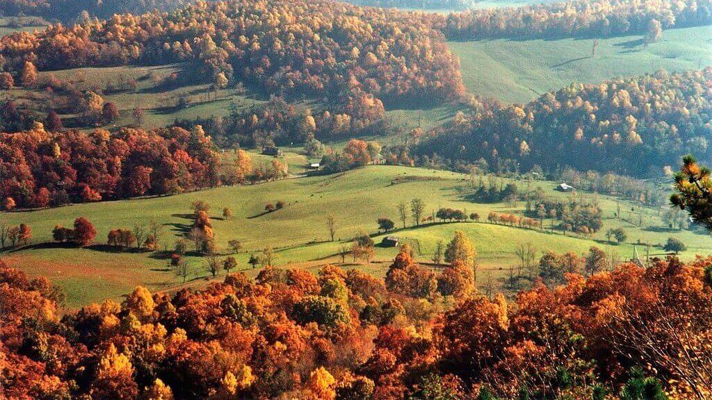
Virginia is a state in the south-Atlantic region of the US surrounded by Maryland to the northeast, the Atlantic Ocean to the southeast, Kentucky to the west, and West Virginia to the northwest. The state also has North Carolina and Tennessee to the south. The Appalachian Mountains cover forested lands in the western part of the state. The other significant mountain ranges in Virginia include the Blue Ridge Mountains and the Allegheny Mountains. Hence, these mountainous regions of Virginia serve as the best hiking locations for climbing enthusiasts.
What is the hardest hike in Virginia?
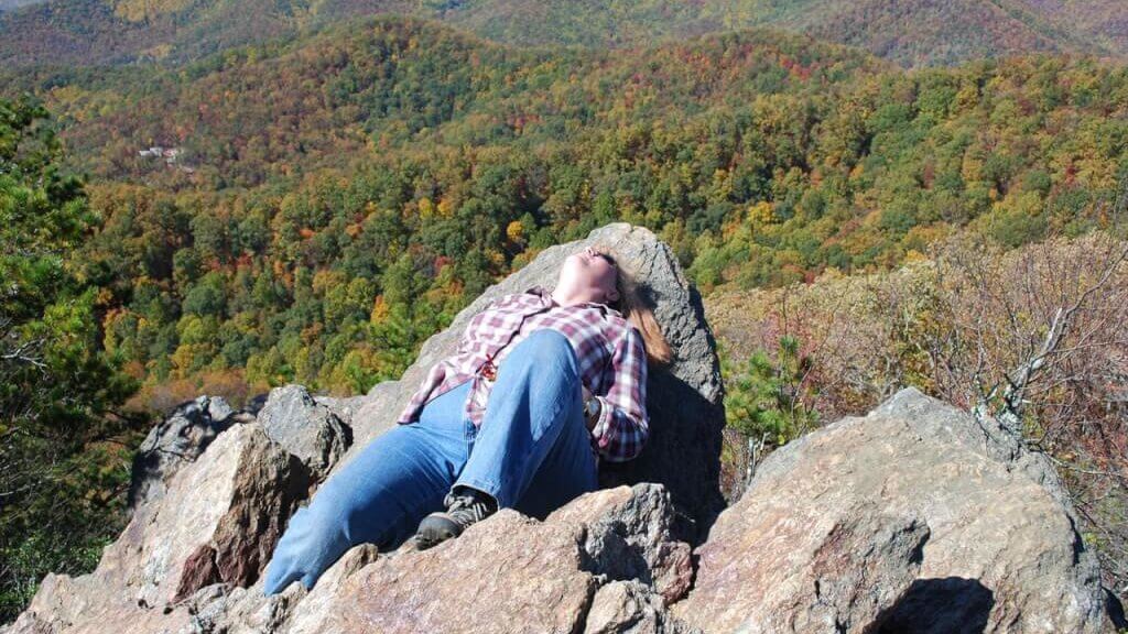
McAfee Knob trail is the hardest hike in Virginia in the Appalachian mountains. Still, it offers spectacular views that no one can deny. Another difficult trek is Old Rag Mountain Loop. It is a beautiful and challenging hike of 5 hrs consisting of rock scrambles and features with unobstructed views. Moreover, Old Rag Mountain Loop in Shenandoah is one of the most popular and dangerous hikes in Virginia. With more than 8 miles of the trek, Old Rag is not for the weak-hearted. So, be careful while choosing the hike destination.
Does Virginia have good hiking?
Yes, Virginia is a hiker’s paradise with many beautiful, challenging, and strenuous treks in the Appalachian and Blue Ridge mountain ranges. There are different paths and trails of varying difficulties, conflicts, and interests. Stunning ranges, large hemlock trees, and flowing waterfalls make a major part of the hiking views of Virginia. Further, Old Rag Mountain Loop, McAfee Knob, Dragon’s Tooth Trail, and Crabtree Falls trail are the best hikes in Virginia with a view.
[elementor-template id=”13257″]
10 Best Trails and Hikes in Virginia
Virginia is home to some of the best hiking trails offering spectacular views of the Appalachian and Blue Ridge Mountain Ranges. Read on to learn more about the different hiking spots, their difficulty levels, weather conditions, and locations.
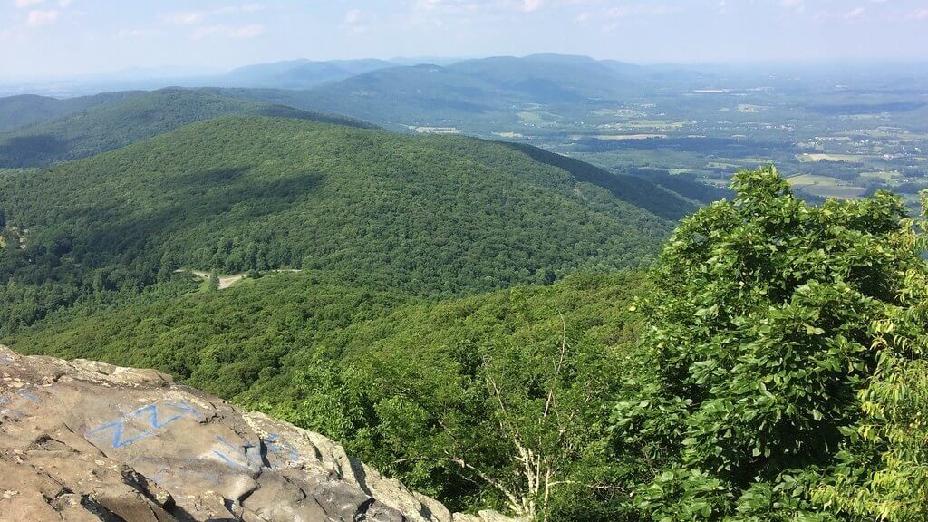
1. Old Rag Mountain Loop
Old Rag Mountain loop is one of the best 25 hikes in the world. The trail is a 9.4-mile strenuous mountain loop in Shenandoah National Park in Elton. Pets are not allowed to trek this trail. It is a popular spot for hikers and climbers as the trails can get crowded. Start with a warm-up hike in Nethers at 600 and carry all trekking accommodations in handy.
Old Rag Mountain Loop is famous for its strenuous and dangerous hike or spectacular forested lands in Shenandoah Park.
The difficulty level of Old Rag Mountain Loop is very hard and challenging. Rock scrambles or structures, elevation, and ascend are difficult to hike.
The perfect time to visit Old Rag is from May to October.
Old Rag Mountain Loop is in Shenandoah National Park, Madison, VA.
How many miles is it to the top of Old Rag?
The top of the Old Rag trail is at 3284 feet in height and the length of the trail reaching the summit is about a roundtrip of 9.8 miles. Old Rag has an elevation gain of 2608 m and takes about 5 hrs to traverse the trek.
Where do you park for Old Rag hike?
There is parking for hikers at the Old Rag Mountain Parking Lot on Nethers Road. A valid one-day Shenandoah National Park permit is required.
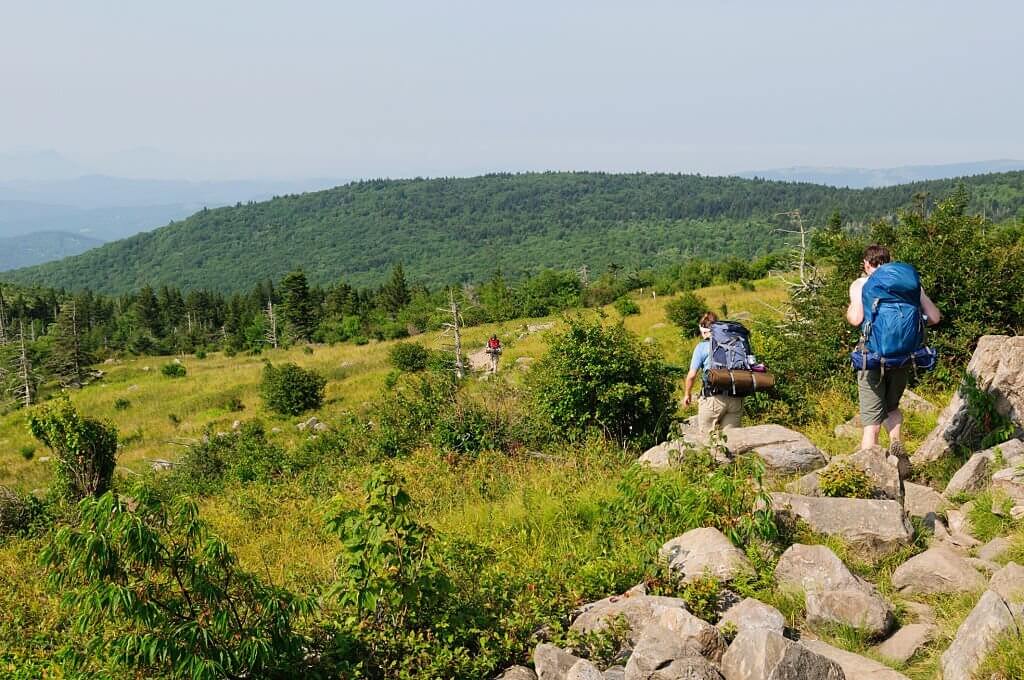
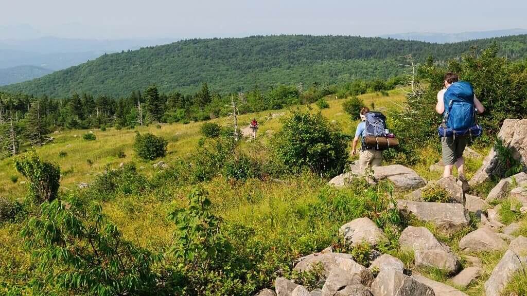
2. Mcafee Knob Virginia
McAfee Knob offers spectacular views and is the most photographed site in the Appalachian mountains towards the front of rocky cliffs. McAfee Knob offers 270 degrees breathtaking views of Catawba Valley and North Mountain to the west, Tinker Cliffs to the north, and the Roanoke Valley to the east. The trail takes over 4 miles to reach the McAfee Knob.
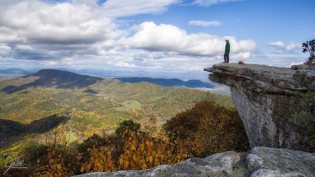
McAfee Knob is famous for its scenic beauty and the rocky cliff protrusions in the Appalachian mountains. It is one of the best hikes in West Virginia.
The trail is moderately challenging, with a length of 12.6 miles.
April to November is the best time to visit McAfee Knob.
McAfee Knob is located on Catawba mountain in Catawba, Virginia.
What mountain is Mcafee Knob on?
McAfee Knob is on Catawba mountain at an elevation of 3197 feet. It is one of the popular biking, hiking, and backpacking highlights in the Appalachian mountains.
Is Mcafee Knob hard?
McAfee Knob is moderately challenging, with a trail length of 12.6 miles near Salem in Virginia. It takes about 4 hrs to hike the trail to reach McAfee.
3. Dragon’s Tooth Trail
This trail is an out and back path overlooking the Roanoke Valley. It is situated at the height of 3000 feet in the Appalachian ranges. Dragon’s Tooth trail offers spectacular views from the jagged rise of the mountain. Parking lots are available and the trail is accessible via route 311 from Catawba.
Dragon’s tooth trail is famous for its ascend of steep, rugged quartzite rocks that form the spine of Cove Mountain and North Mountain. The spine is known as Dragon’s Back and is jagged.
The difficulty level of Dragon’s Tooth Trail is challenging.
The best time to hike Dragon’s Tooth Trail is from March through October.
Dragon’s Tooth Trail is on Catawba mountain, Roanoke County, Virginia.
After such a challenging and tiring activity, having delectable food is crucial. So, there are many restaurants in Virginia highlands to explore.
How long is Dragon’s Tooth hike in Virginia?
The Dragon’s Tooth Hike is a 4.6-mile out and back hike in Virginia on the Appalachian Trail. It takes about 3 hrs to complete the trek.
Is Dragon’s tooth part of the Appalachian Trail?
Yes, Dragon’s Tooth is a part of the Appalachian Trail and has challenging rock scrambles to hike amongst the wildflowers.
[elementor-template id=”13252″]
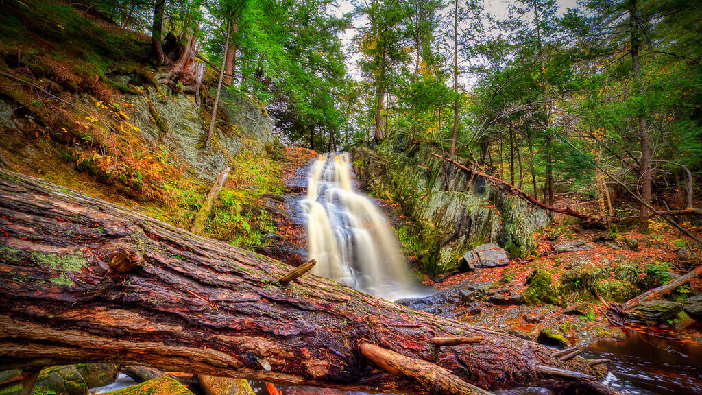
4. Crabtree Falls Trail
The Crabtree Falls Trail is known for its waterfalls and the lower waterfall is just a few yards off the parking lot in North Carolina off Blue Ridge mountains. The trail is about 4 miles with five major cascades and several smaller ones. The highest cascade is to the east of the Mississippi River. The access to Crabtree Falls Trail is from the free parking lot at 11581 Crabtree Falls Highway in Montebello.
Crabtree Falls Trail is famous for its several waterfalls.
The trail is 2.5 miles in length and is moderately difficult to hike with a steep incline along with rocky terrain.
Spring is the best season to hike Crabtree Falls Trail with gushing sounds of water and deer or other wildlife in the forest.
Crabtree Falls Trail is in the Blue Ridge Mountains, Blue Ridge Parkway, Little Switzerland, North Carolina.
To know more about North Carolina and its livability, do read the moving to Va guide.
How long does it take to hike Crabtree Falls Virginia?
The 2.5 miles long hike takes about 1.5 to 2.5 hrs to complete through oak-hickory forests and rocky terrains.
What is the biggest waterfall in VA?
Crabtree Falls is one of the biggest waterfalls in VA, located to the east of the Mississippi River in Nelson County. The waterfall is in George Washington National Forest off Virginia State Route 56.
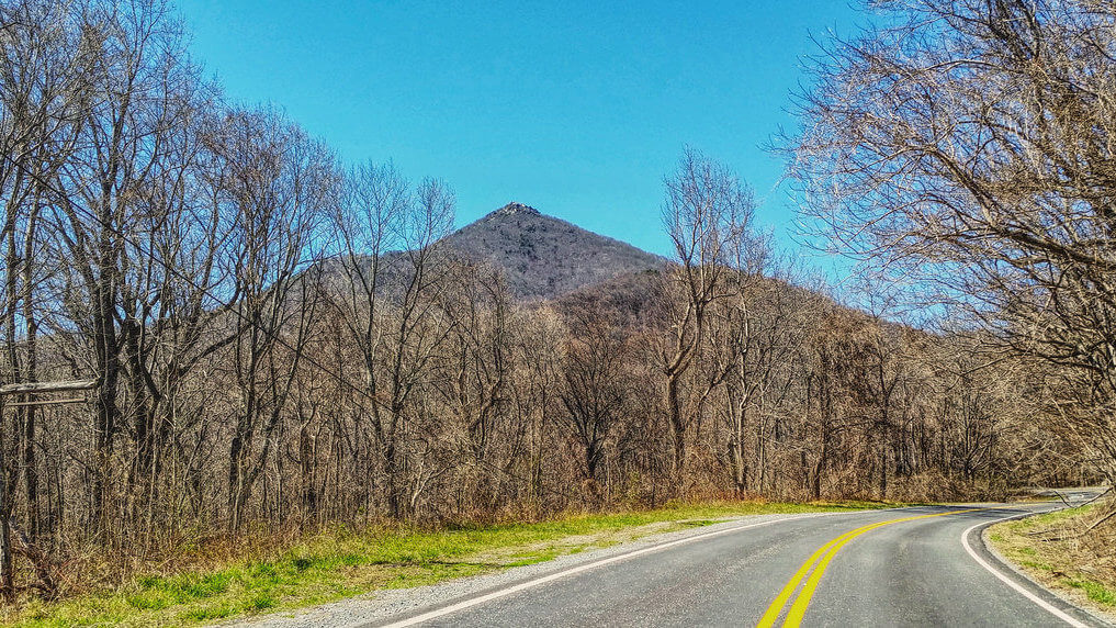
5. Sharp Top Trail
Sharp Top Trail is in Otter Peaks along with Flat Top and Harkening Hill in Thaxton, Virginia. All of these peaks offer amazing 360-degree views. Sharp Top trail is a strenuous climb of 2.5 miles from the base to the summit with an ascent of 1340 feet. Sharp Top Trail is not on the highest of the peaks, even at the height of 3875 feet. There are walkways, stairways, and terraces to the summit.
Sharp Top Trail is famous for birding, camping, and hiking.
The route is moderately challenging in difficulty, with a trail length of 5.3 km out and back.
The best time to visit Sharp Top Trail is from March through November.
Sharp Top Trail is in the Peaks of Otter Recreation Area alongside 86 of the Blue Ridge Parkway, Thaxton, Virginia.
There are many things to do in Norfolk, VA, for families. Read on to learn more about these activities in detail.
How long does it take to hike sharp top VA?
Hikers take an average of 1 hour and 57 minutes to complete the trek via the Sharp Top Trail route.
Where do you park to hike sharp top?
The parking trail to hike Sharp Top is the same as the Flat trail. From Peaks of Otter Visitor Center, travel north alongside Blue Ridge Parkway for 3 miles to reach the destination.
6. Cascades Falls Trail
The Cascade Trail is a scenic roundtrip trail surrounding a shaded mountain creek to a 66-foot waterfall in Jefferson National Forest. The trail is open to the public throughout the year and is pet-friendly. Cascade Falls is one of the most visited falls in Pembroke, Virginia. The Cascades Falls Trail is 4 or 5 miles in length.
Cascade Falls Trail is popular for hiking and the trails are very scenic.
The Cascade Falls Trail is moderately challenging as it is of the out-and-back type.
Cascade Falls Trail is accessible and beautiful throughout the year.
The address of Cascades Falls Trail is 2068 Cascades Drive, Pembroke, Virginia.
How long is the Cascade Falls trail Patapsco?
The Cascade Falls is a 2.1-mile out and back trail that runs along several small streams and large waterfalls.
Where do you park for the Cascade Falls Trail?
One can park near the southern side of Emerald Bay across Inspiration Point to Bayview Point. The trailhead parking in the campground is limited but free.
Above all, Cascade Falls Trail is one of the best hikes in Central Virginia.
[elementor-template id=”13247″]
7. Humpback Rocks Trail
The trail is a 6.1 km loop trail in Nellysford, Virginia, with an elevation of 1099 feet along the Blue Ridge Parkway. Humpback Rocks Trail is a beautiful hike with stunning foliage, spectacular views, and scenic trails. Blue Ridge Parkway is subject to seasonal closure. The trail is in George Washington and Jefferson National Forests.
The trail is a popular area for hiking, camping, and birding activities.
Humpback Rocks Trail is a moderately challenging route with scenic trails.
The best time to visit Humpback Rocks Trail is from April through September and October to November.
The location of the Humpback Rocks Trail is near Milepost 5.8 Blue Ridge Parkway, Lyndhurst, Virginia.
How long does it take to hike Humpback Charlottesville?
It takes about 2.5 hours to complete the loop trek of Humpback Charlottesville. It does not end here. Further, it takes an hour to Humpback Rocks and two hours to Humpback Mountain via the Appalachian Trail.
Humpback Rocks in Shenandoah National Park?
Humpback Rock is one of the most popular hikes offering spectacular views of the Blue Ridge Mountains and Shenandoah National Park and Valley. The maximum summit peak has an elevation of 3080 feet.
8. Hawksbill Loop Trail
Hawksbill Loop is in Shenandoah National Park with a loop trail of 4.3 km near Syria, Virginia. The trail overlooks the Blue Ridge Mountains and Shenandoah Valley. The trail is rocky, with many waterfalls and a great panoramic view. The ascent to the peak is steep. The best view is from the rocks on Salamander Trail before connecting to the Summit Trail.
Hawksbill Loop trail is famous for hiking and camping and attracts huge crowds.
The route is moderate in difficulty and is of short and steep incline.
The best time to visit Hawksbill Loop Trail is from April through November.
The location of Hawksbill Loop Trail is in Shenandoah National Park, Virginia.
Where do you park for the Hawksbill trail?
A parking facility is available in the Hawksbill Gap Parking Area and lower Hawksbill Parking Lot that can accommodate a limited number of vehicles.
Is dragon’s tooth part of the Appalachian Trail?
Yes, Dragon’s Tooth is indeed a part of the Appalachian Trail and is on Cove Mountain. It is a gradual climb for a mile and then becomes strenuous once it joins the Appalachian Trail. Don’t be surprised if we say Dragon’s Tooth has a hike length of 2.3 miles.
9. Dark Hollow Falls Trail
Dark Hollow Falls Trail is the most visited in Shenandoah National Park, being steep and rocky. The elevation gain is about 440 feet with a challenging return climb. Further, the trail is a 1.4-mile circuit hike. There are water cascades at 70 feet down the side of the mountain.
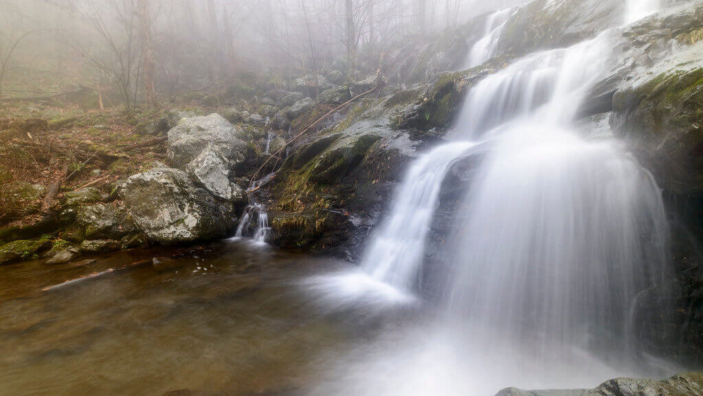
The trail is famous for its wildlife, flora, and fauna. Hiking and walking can be done along the scenic trail.
The trail is moderate in difficulty and is of the out and back style.
The best time to visit Dark Hollow Falls Trail is from April through October.
The location of Dark Hollow Falls Trail is in Shenandoah National Park, Virginia.
How tall is Dark Hollow Falls?
Dark Hollow Falls is a cascade type of waterfall with a height of 70 feet. It is one of the most visited waterfalls in Shenandoah National Park, near Skyline Drive.
Where do you park for the Hawksbill trail?
A parking facility is available in the Hawksbill Gap Parking Area and lower Hawksbill Parking Lot that can accommodate a limited number of vehicles. Make sure to reach the parking area early to catch the slot.
[elementor-template id=”13242″]
10. Stony Man Trail
Stony Man trail is 1.6 miles in length and offers spectacular views of Shenandoah National Forest. The trail is circuit-type, featuring wildflowers in the spring and summer seasons. However, pets are not allowed on this trail. Is there snow in Virginia, and other weather conditions are explained in detail, give it a read.
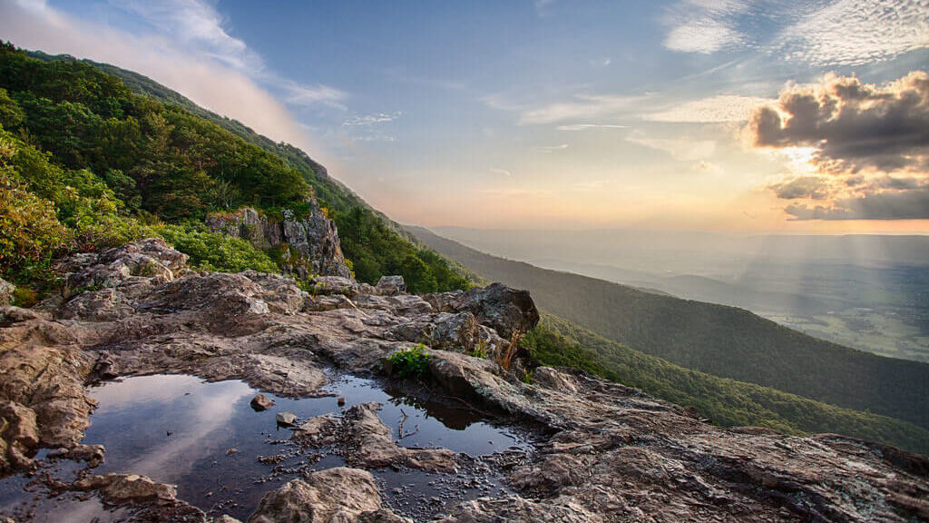
Stony Man Trail is famous for its scenic views and hiking trails.
The trail is of easy difficulty and is one of the popular hikes in Virginia, conducive for all age groups.
The best time to visit Stony Man Trail is from April through September, taking about 43 mins to complete the trek.
The circuit trail is situated near Milepost 41.7 on Skyline Drive near Luray.
Where do you park to hike Humpback Rock?
Humpback Gap Overlook Parking at milepost 5.8 has parking spaces for Humpback Rock. The parking space is limited and is only confined to a couple of dozen cars.
How long is Stony Man Trail?
The Stony Man Trail is 1.6 miles in length and has 340 feet of elevation change. The quickest trip to the mountain top is via Stony Man Trail.
Best hikes in Virginia FAQs
Where should I hike in Virginia?
Virginia is home to mountainous regions of the Appalachian Trail and the Blue Ridge Mountains. Stony Man Trail is one of the easiest hikes in Virginia for all age groups and is a perfect picnic spot. Moreover, hiking in Virginia is exploring areas of large hemlock trees, flowing waterfalls, wildflowers, Blue Ridge Mountain, and rhododendron fields. In short, Virginia is a hiker’s paradise and holds a special place for all hikers.
Conclusion
Virginia is a state of hiking, and there are multiple trails of varying types, lengths, and difficulties. The mountainous regions of Virginia offer different terrains to hike and breathtaking sceneries to explore.
Now that you have learned about the best hiking places in Virginia, what are your views on the hiking trails and views? If you are a hiking enthusiast, consider exploring Virginian trails, locations, and scenic views.
Make sure to research well before hiking any of the popular spots in Virginia.
[elementor-template id=”13252″]